Featured
The Critical Role of Geospatial Intelligence (GEOINT) in America’s Golden Dome Missile Defense System
November 6th, 2025
In an era of escalating global threats—think hypersonic missiles from China or ICBMs from North Korea the United States is doubling down on […]

In an era of escalating global threats—think hypersonic missiles from China or ICBMs from North Korea the United States is doubling down on its missile defense capabilities. Enter the Golden Dome, a next-generation missile defense system inspired by Israel’s Iron Dome and mandated by President Donald Trump’s January 2025 executive order. But what’s the secret sauce behind this ambitious shield? Geospatial Intelligence (GEOINT) is emerging as a game-changer, powering America’s defense against aerial attacks. In this article, we’ll explore why GEOINT is critical to the Golden Dome, how it enhances missile defense, and why it’s a cornerstone of the U.S.’s national security strategy in 2025.

What Is GEOINT and Why Does It Matter?
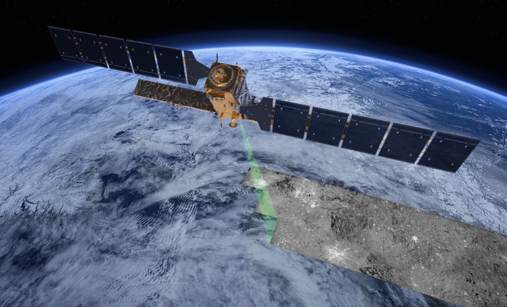
Geospatial Intelligence, or GEOINT, is the use of satellite imagery, geospatial data, and location-based analytics to understand what’s happening on (and above) Earth. It’s like giving the military a high-definition map that updates in real time—think Google Earth on steroids, but with a national security twist. For the Golden Dome, GEOINT isn’t just a nice-to-have; it’s the backbone of a system designed to protect against everything from drones to intercontinental ballistic missiles (ICBMs).
With the U.S. facing sophisticated threats across its 3.8 million square miles, GEOINT bridges the gap between Israel’s regionally focused Iron Dome and America’s need for a nationwide shield. Let’s dive into the key ways GEOINT supercharges this missile defense initiative.
“Geospatial Intelligence is the most critical element in the execution of Golden Dome operations, if we don’t understand where threats are, or where our defense is most necessary – we don’t have a dome at all, we have really expensive swiss cheese.” -Nick Smith, CEO Geo Owl
1. Spotting Threats Before They Strike

Imagine a missile launching from halfway across the globe. How do you catch it in time? GEOINT makes it possible. By tapping into satellites and advanced sensors, GEOINT provides early warning by detecting launches from adversarial hotspots like Russia or China. Unlike Israel’s Iron Dome, which tracks short-range rockets over a small area, Golden Dome needs global reach. GEOINT delivers that, giving the U.S. precious minutes to respond—whether it’s scrambling interceptors or alerting command. GEOINT professionals make it happen!
2. Pinpoint Accuracy for Interceptors
Hitting a hypersonic missile traveling at Mach 5+ is no easy feat. GEOINT steps in with high-res imagery and 3D terrain modeling to guide interceptors with surgical precision. This is especially crucial for the Golden Dome’s goal of “boost-phase intercepts”—nailing missiles right after launch. By mapping trajectories in real time, GEOINT ensures every shot counts, reducing waste and boosting effectiveness. It’s a leap beyond Iron Dome’s simpler targeting, tailored to America’s complex threat landscape.
3. Real-Time Situational Awareness for Golden Dome
Picture this: a swarm of drones heads toward a U.S. city. GEOINT fuses data from space, air, and ground sensors to create a live battlefield picture. This situational awareness lets commanders see threats unfold and react instantly—whether it’s deploying mobile defense units or coordinating with space-based assets. For the Golden Dome’s “summer program” pilot planned for mid-2025, GEOINT will be key to proving the system works in real-world scenarios.
4. Protecting What Matters Most
The U.S. can’t defend every inch of its territory at once—it’s just too big. That’s where GEOINT shines, identifying critical assets like military bases, power grids, and urban centers. By mapping vulnerabilities, it helps Golden Dome prioritize defense where it’s needed most, much like Iron Dome focuses on Israel’s populated areas. This cost-effective approach aligns with the 2022 National Defense Strategy (NDS), which calls for resilience against peer adversaries.
5. Tying It All Together: Integration and Interoperability
Golden Dome isn’t starting from scratch—it’s building on systems like Patriot and THAAD. GEOINT acts as the glue, linking these layers with new space-based sensors and interceptors. It ensures seamless data flow across domains, a must for the Army G-2’s multi-domain operations focus. Whether it’s tracking a cruise missile or syncing with allies like Israel, GEOINT makes Golden Dome a unified shield.
6. Understanding the Enemy
Knowledge is power, and GEOINT delivers it by analyzing adversary capabilities. From spotting missile test sites to tracking launch patterns, it helps the U.S. stay ahead of threats like China’s hypersonic advances. This aligns with Army G-2 guidance under Lt. Gen. Tony Hale, which prioritizes deep threat understanding. For Golden Dome, GEOINT isn’t just about reacting—it’s about anticipating.
How GEOINT Fits the Bigger Picture
The Golden Dome isn’t just a tech project it’s a strategic move. The 2022 National Defense Strategy emphasizes deterring powers like China and Russia, and GEOINT supports this by enabling integrated deterrence across air, space, and ground. It also fits Army G2’s push for intelligence-driven operations, delivering speed, precision, and multi-domain awareness. As the Department of Defense races to meet the executive order’s 60-day planning deadline (March 28, 2025), GEOINT will be central to a “summer program” pilot, proving the system’s value.
Why GEOINT Makes Golden Dome a Game-Changer
Israel’s Iron Dome taught us efficiency and adaptability, but America’s threats demand more. GEOINT takes missile defense to the next level, offering global reach, precision, and smarts. It’s not just about stopping missiles—it’s about outthinking adversaries and protecting what matters. As Golden Dome rolls out, expect GEOINT to be the unsung hero keeping the U.S. safe in 2025 and beyond.
Ready to Learn More? Stay tuned for updates on Golden Dome’s progress and how Geo Owl is shaping the future of U.S. defense!


