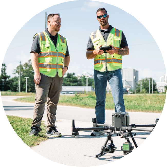
WHY US?
Geo Owl provides more than just certified UAS pilots. We provide highly credentialed geospatial professionals who are well-versed in the intricacies of collecting, processing, and
analyzing remotely sensed UAS data from a wide range of sensors. Our company focuses on safety and quality to deliver accurate data and intelligence insights to your organization.
Planning, Collection, Processing, Analysis
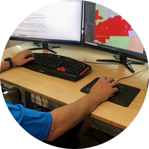
Geo Owl’s end-to-end UAS Services begin with a thorough consultation to discuss the job requirements and timing, then plan and schedule the collection. Our field technicians perform the data collection at your site using the best data capture tool for your specific needs, including UAS-based photogrammetry and UAS-based LiDAR. After the data is collected, it is sent to our geospatial analysts for processing, analysis, and deliverables creation.
Geo Owl’s UAS support team is available to answer any questions and explain the data, so you have full understanding of how to apply these insights to your business or use case.
Inspection & Monitoring
Whether it’s pipelines or powerlines, utility providers spend billions of dollars per year inspecting, monitoring, and maintaining their infrastructure, frequently in difficult-to-access or hazardous locations. UASs offer a safe alternative to traditional utilities infrastructure inspection methods, which require personnel to navigate potentially hazardous terrain or climb to dangerous heights.
UAS inspections are also more cost-effective than traditional inspections, which may cost $1000 per mile of aerial inspection with a helicopter. Geo Owl’s UAS-based infrastructure inspection solutions are customizable to include powerlines, bridges, cell phone towers, commercial rooftops, and gas detection.
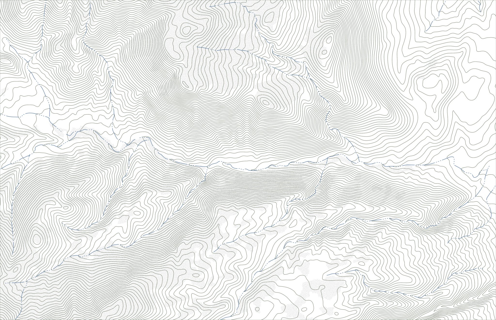
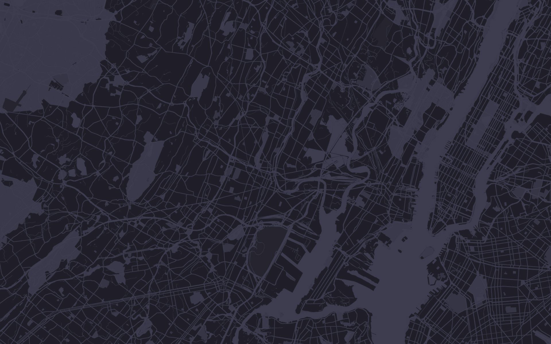
Mapping
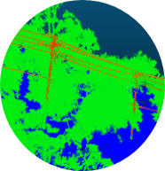
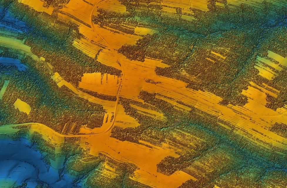
Geo Owl offers a range of UAS Mapping Solutions, including aerial photogrammetry and LiDAR. Our photogrammetry services include both 2D and 3D mapping using industry-leading sensors and structure-from-motion processing software. Photogrammetry is accessible for nearly all budgets and is suitable for a wide range of use cases but may struggle to pick out small or detailed objects, or in vegetated environments.
Where extra precision is required, Geo Owl’s affordable LiDAR services detect features such as powerlines and can penetrate through vegetation to capture the structure of the underlying terrain. Geo Owl’s UAS experts will work with your requirements to determine the right tools for your project and budget.
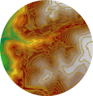
LiDAR
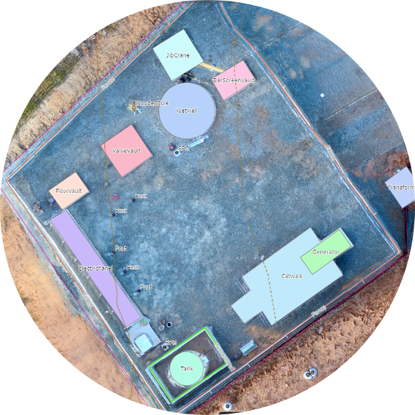
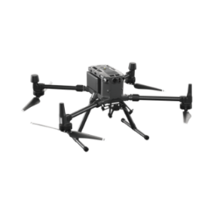
By deploying a UAS equipped with a LiDAR sensor, Geo Owl can collect data to create 3D models with centimeter-level accuracy and detection of features that would be indistinguishable with other types of sensors. Our LiDAR capability includes the DJI Zenmuse L1 sensor onboard a Matrice 300 RTK. The L1 sensor combines a Livox LiDAR module, high accuracy IMU, and RGB camera to produce colorized point clouds and high accuracy reconstruction models.
Geo Owl offers end-to-end solutions for a range of use cases including topographic mapping, emergency response, forestry management, wetland and shoreline mapping, and energy/infrastructure.
RGB
RGB sensors are the standard sensor which most drones are equipped with. RGB simply stands for Red Green Blue and is a fancy name for a standard camera. These sensors capture the same wavelengths as the human eye, so imagery collected by these sensors will match what we see in real life. Geo Owl effectively captures data over large areas using an RGB sensor by flying mapping missions. On a mapping mission, we program the drone to fly in a specific pattern, taking pictures at regular intervals.
These pictures have a lot of overlap (both front and side overlap) to enable photogrammetry software to process these images and produce useful data outputs, like orthomosaics, point clouds, and digital elevation models. We also offer standard high-resolution video capture and full-motion video analysis for intelligence insights through our proprietary Patternflows software.
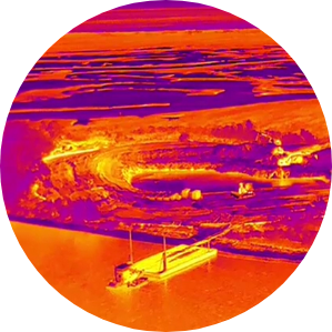
Thermal
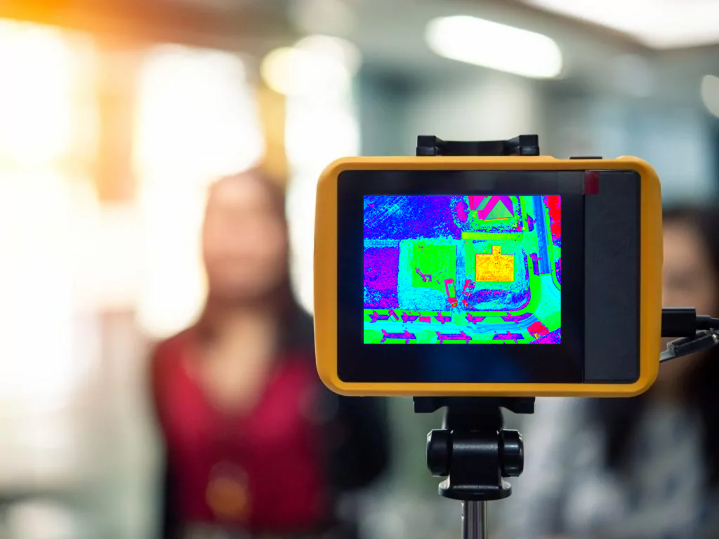
Geo Owl offers specialized UAS sensors, flight services, data processing services, and training for thermal (infrared) data. When deployed on a drone, thermographic sensors enable the collection of radiometric data over wide areas and in hard-to-reach places.
Geo Owl’s H20T thermal sensor features built-in visual imaging and heat analytics to make thermal analysis efficient, cost-effective, and accessible to a wide range of applications including: electrical inspections in buildings, electrical plants, substations, and towers; identifying water leaks and inefficiencies in building structures; identifying heat stress and water use efficiency in vegetation; wildlife detection and monitoring; and public safety.
Multi-Spectral
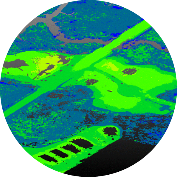
Using multispectral sensors onboard our UAS, Geo Owl provides high-quality insights for a range of vegetation monitoring and management applications across multiple industries including forestry, coastal and wetland monitoring, invasive species management, utilities, and agriculture.
Our expertise includes UAS image pre-processing for radiometric, spectral, and spatial calibration, and mosaicking; integration of UAS imagery with other ground-based datasets; object- and pixel-based imagery classification approaches for vegetation and land cover; and artificial intelligence/machine learning based imagery processing approaches.
Contact Us
Questions?
We will
always be
Vigilant