Imagery exploitation
EO, SAR, MSI, and FMV analysis across open-source and commercial collections.

 Start a conversation
 Turn the requirements you can’t get to into analyst-validated answers. One team manages the collection, technology, analysis, and delivery. You focus on the decision.
Mission requirements in.
Decision-ready intelligence out.
U-GAME is a managed GEOINT capability from Geo Owl. Give us the mission requirement; we coordinate the collection, data, technology, and analysts to deliver a scoped intelligence outcome. From an urgent assessment to persistent monitoring, we help move work off the deck and into the decision.
See how one question becomes a coordinated GEOINT answer—and what your team can expect along the way.
Read the U-GAME field guideChoose a starting point. We shape the sources, cadence, analysis, and delivery around your mission.
 WORKFLOW VISUALIZATION / NOT A LIVE FEED
Move from an image collection to an assessed picture of activity. Establish a baseline, monitor meaningful changes, and understand what deserves attention.
POTENTIAL DELIVERABLESConfigure the area, cadence, analytics, and delivery around your mission. Sources, collection access, and turnaround are confirmed during scoping.
Landing zones, critical infrastructure, reference imagery, and routing across eight areas of interest. A real example of rapid GEOINT production.
See the work Past performance is not a turnaround guarantee. Timing depends on scope and source availability.U-GAME extends your team with an unclassified production environment, cleared-community tradecraft, modern tools, and analysts ready to move from requirement to finished GEOINT.
From the map to the model, U-GAME connects the complete GEOINT production chain under one accountable team. Specialist support is tailored to your scope.
EO, SAR, MSI, and FMV analysis across open-source and commercial collections.
Foundational data, map production, attribution, boundaries, and operational planning products.
Rapid model development, training, testing, validation, scripted detections, and analyst-led QA.
In-depth geospatial research that fuses authoritative, commercial, and open data.
Point-cloud processing, classification, quality control, elevation products, and change analysis.
Structured observations, monitoring, crisis response, studies, and IC-ready reporting.
A repeatable workflow. A named operations lead. Visibility into the sources, progress, and products behind the answer.
Your question, area, recipients, and acceptance criteria.
Fit-for-purpose commercial and open-source data.
Normalize and prepare the inputs for analysis.
Tradecraft and appropriate AI turn data into findings.
Human review adds context, confidence, and rigor.
Agreed products, alerts, or data in your workflow.
Stay close to the work with an operations lead, agreed updates, work-in-progress visibility, and a review against your acceptance criteria.
Talk through your requirement“Geo Owl is the gold standard of communication.”
SPACE FORCE CLIENT
We bring the standards, mission context, and organizational memory of nationally vital GEOINT operations into a purpose-built unclassified production environment.
Geo Owl teams have delivered around-the-clock geospatial intelligence for Special Operations Forces and the Intelligence Community, including products used at the highest levels of government. U-GAME carries those hard-earned lessons into the commercial space, where shareable data, modern infrastructure, and the latest AI tools let the mission move faster.
Our analysts, cartographers, scientists, engineers, and model developers work as one production discipline. The result is not a disconnected vendor stack, it is an experienced GEOINT team built to understand the requirement, surge quickly, and stand behind the finished product.
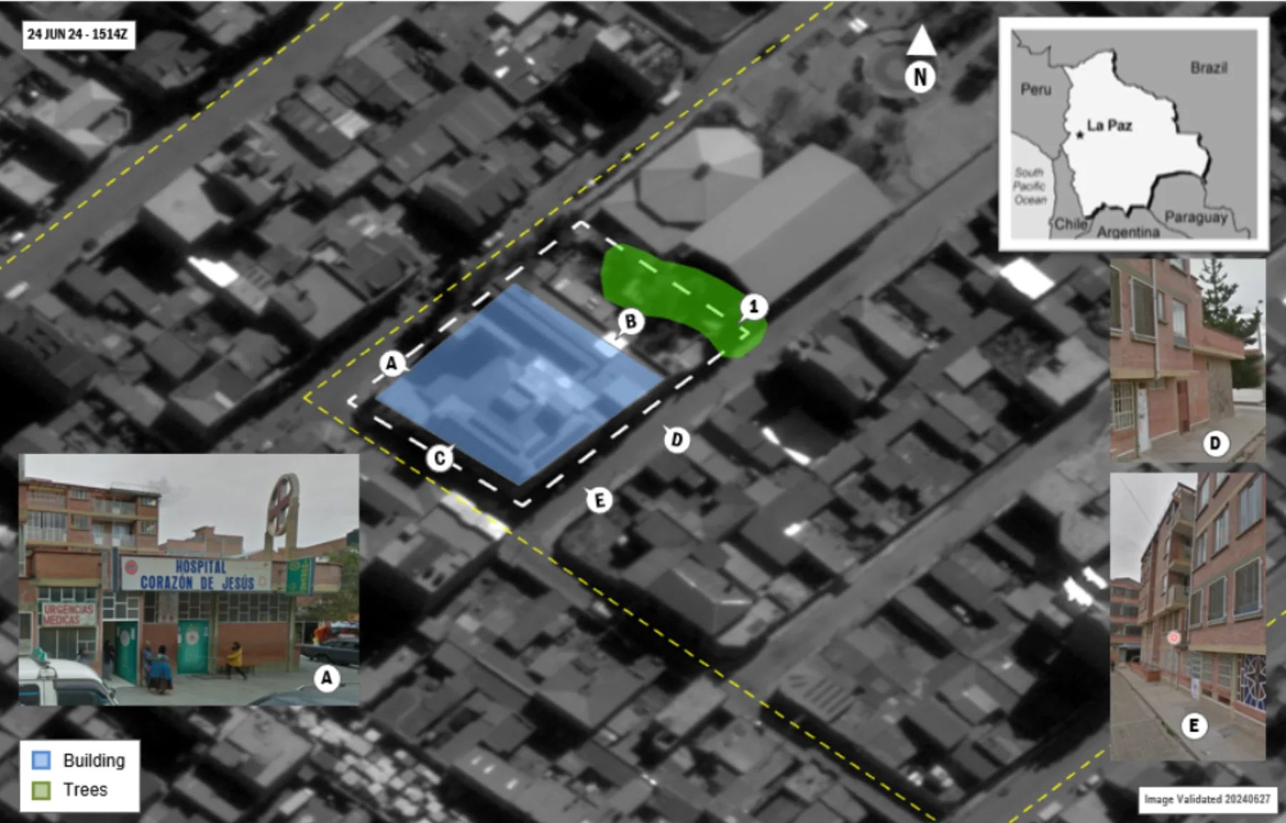
Representative unclassified work shows how mixed sources, human tradecraft, and machine velocity resolve operational constraints.
Eight areas of interest resolved into landing zones, critical infrastructure, reference imagery, and optimal routing.
Read mission profile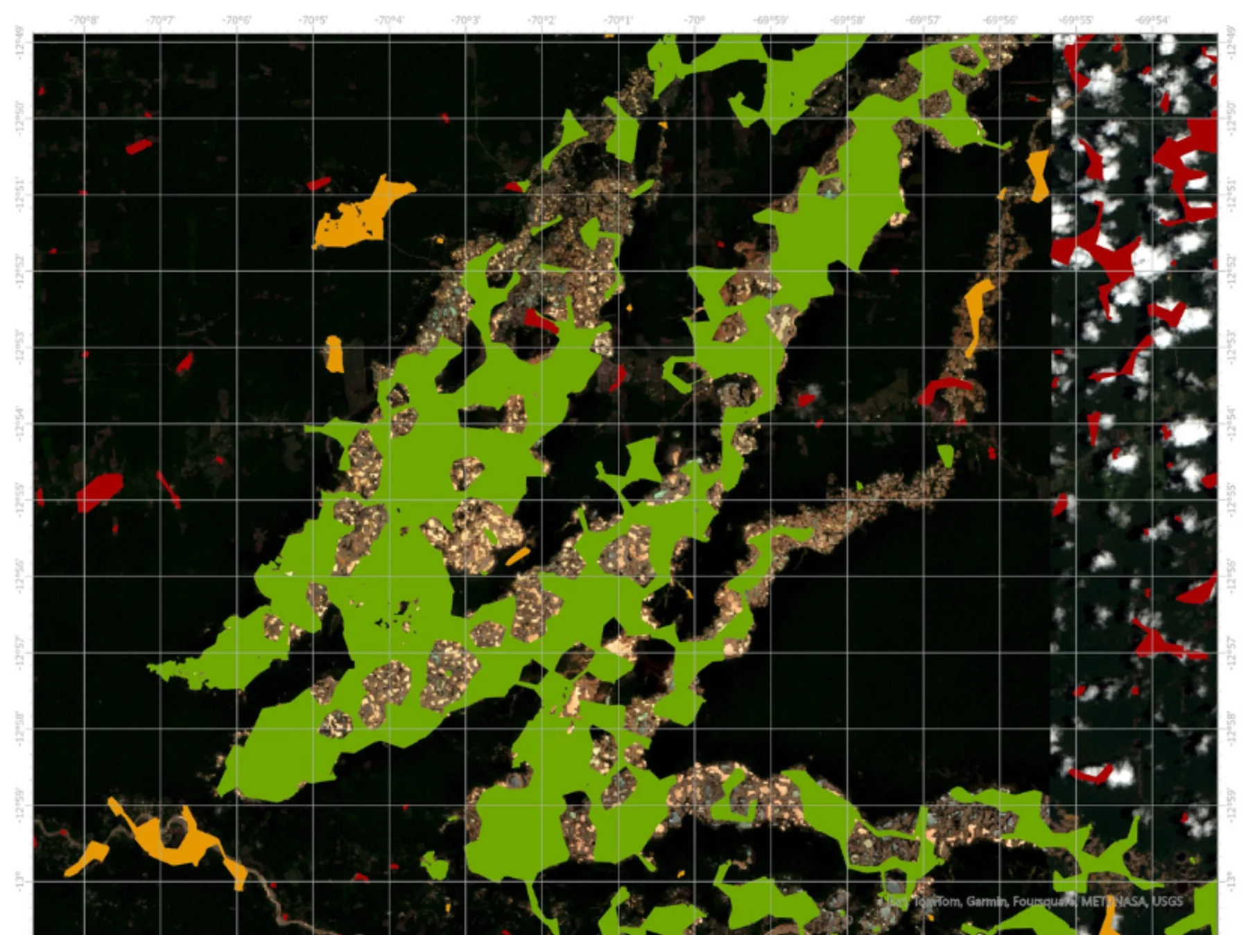
Commercial and open imagery, geological data, machine learning, and analyst validation produced attributed predictions.
Read mission profile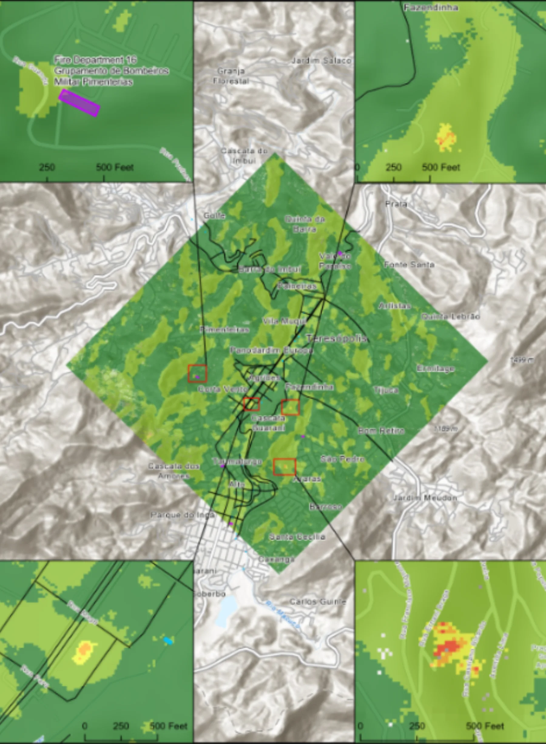
Rapid change detection paired potential flooding with roads, bridges, hospitals, and emergency-response infrastructure.
Read mission profile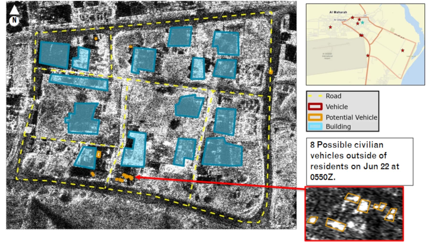
Radar and optical collections exposed traffic patterns and possible civilian or military vehicle activity across eight areas of interest.
Read mission profile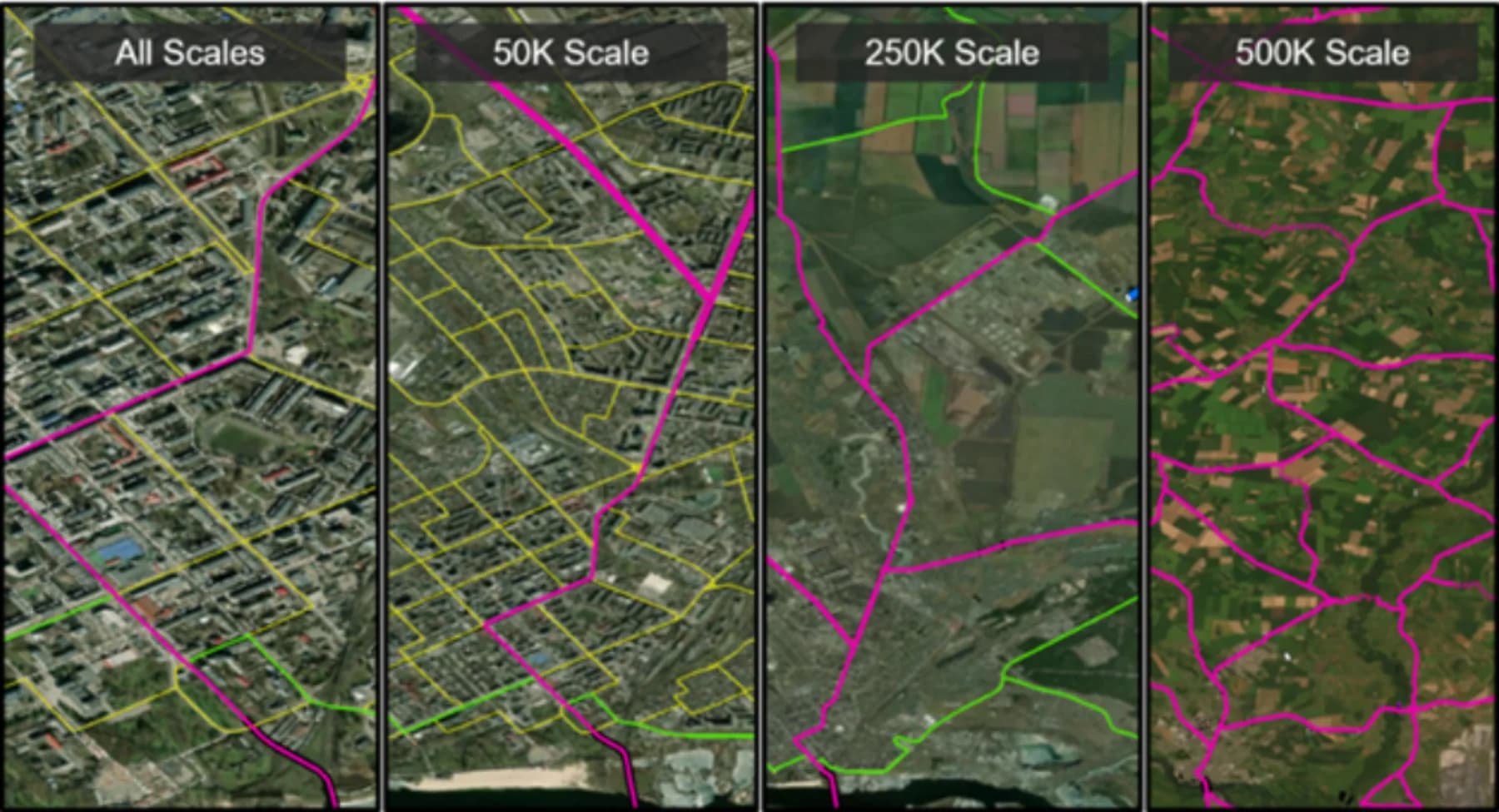
Authoritative vector data was digitized, attributed, quality controlled, and maintained across scales for dependable operational use.
Read mission profile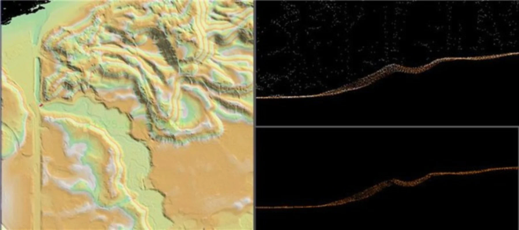
More than 100 LiDAR tiles were reviewed and corrected to remove artifacts, restore terrain continuity, and enable downstream products.
Read mission profileSupporting U.S. intelligence and military missions—and collaboration with approved international partners—starts with who needs the product.
Commercial + open data
Analyst-validated GEOINT
Release + license checks
Approved mission partners
Name the recipients at the start. We scope data rights, formats, and delivery around your intended use. Sharing remains subject to licensing, applicable controls, and customer approval.
Your requirement determines the workflow, collection needs, analysis, and service level. Scope, acceptance criteria, and commercial terms are agreed before work begins.
Define success with usTrack accepted requirements and delivered products.
Shift sourcing and production effort into one coordinated workflow.
Match sources, tools, and specialist support to the question.
Human-reviewed findings, source visibility, and agreed standards.
U-GAME is a managed GEOINT capability. Geo Owl coordinates sources, technology, specialists, analysis, validation, and delivery around an agreed mission requirement. You buy a scoped outcome, not just software access or a seat.
Yes. Geo Owl provides 24/7 mission support, and some scoped requirements can be completed in hours. Timing depends on complexity, collection access, and imagery availability. We confirm feasible turnaround with you before committing.
Partner sharing is planned during intake, not assumed. Tell us the intended recipients and use. Delivery is subject to source licenses, applicable controls, customer authorization, and any required release review.
We scope the workflow around your question and delivery environment, including available customer data, licensed sources, and agreed output formats. Integration and access requirements are confirmed during scoping.
Pricing depends on the workflow, collection management, data consumption, optional analytics, and service level. We agree the scope, deliverables, acceptance criteria, and commercial terms before work starts.
Start with one real requirement. Together, we’ll define the scope, source options, deliverables, timing, and investment.
Straight to our team. No sales portal. Fields marked * are required.
Checking secure submission availability…
Prefer email? ugame@geoowl.com