- Coastal wetland environment
- Fine-scale vegetation boundaries
- Cross-year imagery differences
 Start a conversation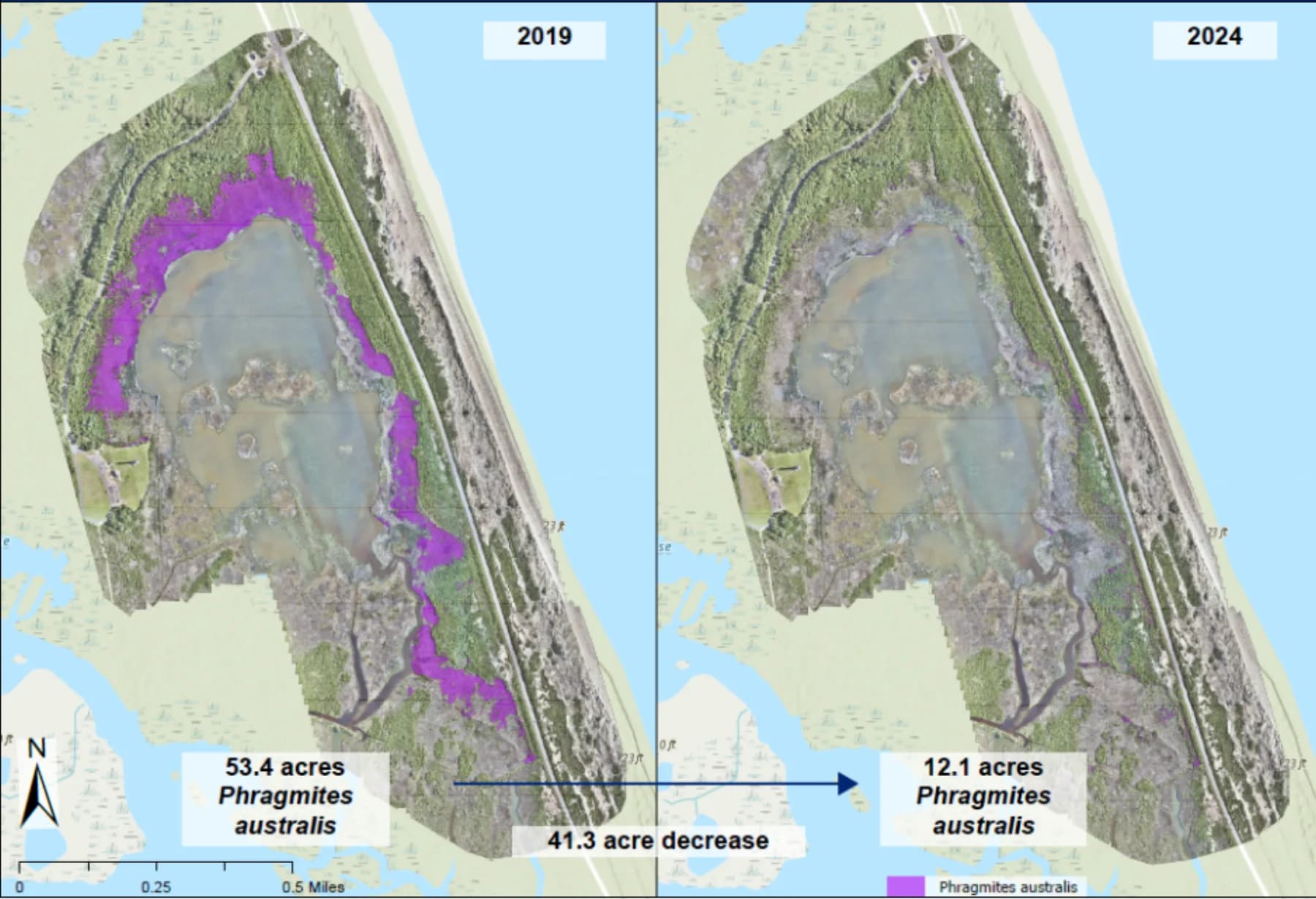
Solutions library
EnvironmentalCape Hatteras, North Carolina
PHRAGMITES / CAPE HATTERAS
Five years of high-resolution imagery quantified a 41.3-acre reduction in invasive phragmites.
MISSION PROFILE07 / 08
01 / OPERATIONAL BRIEF
THE
OBJECTIVE.
Measure the changing extent of invasive Phragmites australis to support habitat restoration decisions.
- 2019 high-resolution imagery
- 2024 high-resolution imagery
- Wetland and shoreline basemaps
02 / ANALYTICAL METHOD
Delineate invasive vegetation in each observation year
Normalize the two mapped extents
Calculate and communicate net habitat change
03 / MISSION OUTCOMES
WHAT
CHANGED.
Reviewable intelligence built for the next decision, not the final presentation.
53.4 acres mapped in 2019
12.1 acres mapped in 2024
41.3-acre decrease documented
START WITH
THE MISSION.
Bring the requirement. Geo Owl brings intelligence professionals, GEOINT expertise, mission data, and technology to help you collect, understand, and act.
Bring Us Your Mission View our capabilities